Is it possible to create a georeferenced hotspot surface in Unity?
I am relatively new to Unity. I went through some basic tutorials but now I'm asking myself if the thing I am trying to accomplish is actually possible with Unity. It's very different form what usually begin with in the tutorials.
What I'm trying to do is, I want to create a georeferenced hotspot surface in Unity. You might not know what that is, so here is an image of how this would look like:
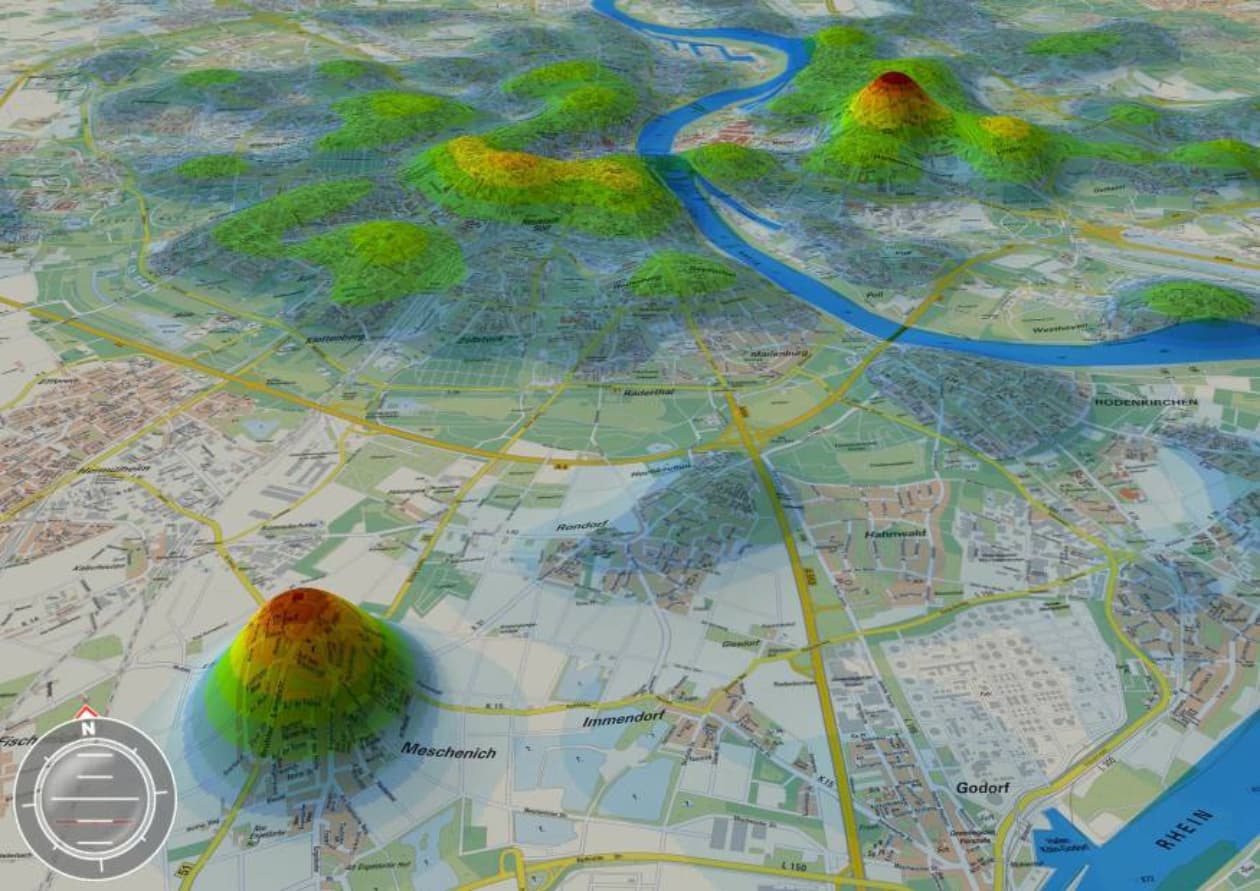
Maybe think of a long table with 3 columns. The first two columns contain X and Y coordinates, the third column contains an absolute value (could be temperature for instance). I want to create a 3D plane out of this in Unity.
Also I want to map this on a real world map (maybe even with 3D buildings of a city and 3D terrain). I've seen some tutorials showing how you could create a 3D version of a city or real world terrain in Unity.
But would it be possible to create the 3D plane in Unity and mapping it onto the city model? Mapping means, the coordinates need to match.
And then the ultimate step would be: If I had a time series of this (one "data table" for every hour of the day) could I animate the 3D plane to change over time?
Would this even be possible? And if so, where do I need to start? What kind of tutorials do I have to look for, or what features do I have to look into, to make this happen?
