- Home /
 
               Question by 
               elektamas88 · Mar 26, 2014 at 09:50 AM · 
                c#graphicsopengl  
              
 
              Visibility Analysis from point on terrain
I have a c# .net project, and I use OpenGl for drawing. I have lat/lon/alt values in *.csv files, and I load values from them if it needed. I have a 2D map like this:

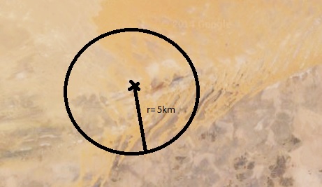
Within the circle I would like to know which areas are visible from a given point and also the exact percentage they take of the full area. Actually I want to draw in OpenGl something like this: 
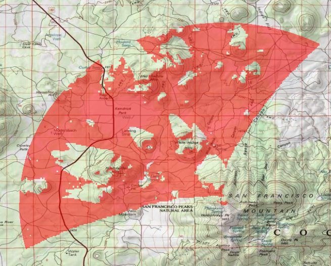
Do somebody have any idea how can I do this?
 
                 
                untitled.jpg 
                (34.7 kB) 


               Comment


              Your answer
 
 
             Follow this Question
Related Questions
Multiple Cars not working 1 Answer
Distribute terrain in zones 3 Answers
Smoothing Directionally between three materials 1 Answer
How to use Matrix4x4? 2 Answers
Dropdown menus for settings have randomly stopped working 1 Answer
 koobas.hobune.stream
koobas.hobune.stream 


                