- Home /
How would you implement a dynamic region borders visualization system?
Hi,
For a project, I need to display the 3D borders of a region computed dynamically; my region is composed of multiple "region entities", each having a radius of influence, and I want to
Make a union of all the influences of a given region
Actually display this influence on the ground
Think of it as in Civ 5 influence borders (red-white on this example).
For now, I managed to do it by creating a texture per region, projecting the position and influence of every element contained in this region on it (making the union) and then displaying the texture on a plane. It works as intended, but there are a couple limitations:
The texture obviously has to be fixed size, so the region as a whole can't be larger than an arbitrary "x" value (square)
The rendering quality is not really optimal. I tried generating/disabling mipmaps for my generated texture, playing with qualities and stuff, but couldn't get better than this.
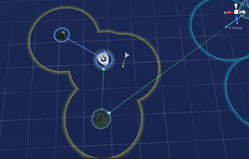
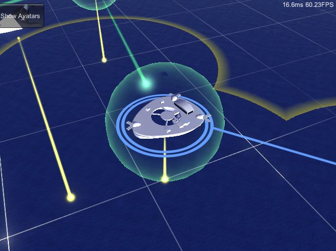
Shots of the current result (yellow outline):
From far above (result ok) 
From closer (result less ok, due to texture limitations) 
Anyone would have an idea on how to do this in a better way?
Your answer

